Old Wayfinding, New Walks: Coastal Navigation Lessons for Everyday Walkers
Problem: Why many ordinary walks feel uncertain
It has become common, even on short local walks, to end up depending on a smartphone map or confusing signage. Devices are useful, but battery limits, signal gaps, and tilted screens can make orientation fragile. At the same time, changing shorelines, seasonal vegetation, and new developments can erase the familiar cues a walker once trusted. The result is a quiet anxiety that turns a pleasant walk into a series of checks and rechecks.
Looking back to how people moved along coasts and through commons for centuries offers a simple corrective: a small set of reliable, human-scale cues and a habit of reading the landscape. These techniques were practical rather than romantic—fishermen, shepherds, and traders learned to notice and use what the land and sea themselves provided. Adapting those lessons makes modern walks more resilient, attentive, and enjoyable.
Principles: What traditional wayfinding teaches us
These are four compact principles drawn from historical practice and useful today.
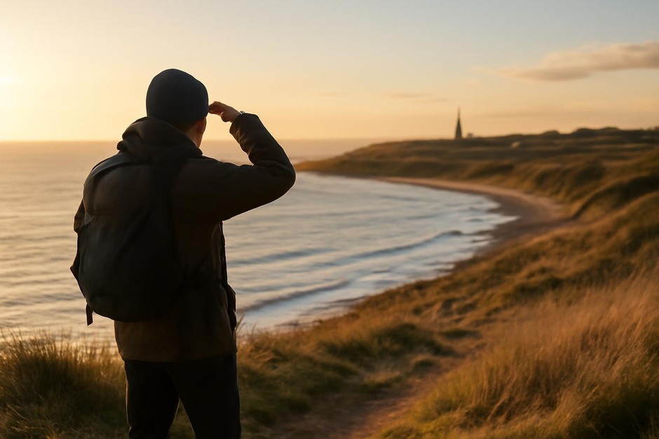
- Prioritize stable landmarks. Natural and human-made features that move little over years—headlands, church towers, bridges—offer fixed bearings within a local area. Even a single visible spire or cliff notch can serve as an anchor for orientation.
- Read the sea and light. Tides, swell direction, and the angle of sunlight reveal orientation and time of day in ways a map cannot. Fisherfolk timed returns to harbor by swell and wind; walkers can use the same cues to judge distance and approach.
- Favor multi-sensory cues. Sound and smell are often underrated. The hush of a reedbed, the slap of surf, or a distant factory bell can locate a feature when visibility is poor.
- Use human traces as memory aids. Paths worn into grass, stone cairns, fence gaps, and painted posts are histories of other people’s movement—follow them with care, knowing they indicate regular lines of travel.
Examples: Applying the principles on everyday routes
1. A village approach from the shore
Historically, small coastal villages oriented themselves toward a single church tower or quay light. On a modern walk, pick out the tallest visible structure and note its compass direction before you start. If the tower lies inland to the left as you round a headland, you can estimate your lateral progress without checking your phone. When visibility drops, move toward the sound of village activity—dogs, clinking boats, or the call of gulls near harbor walls.
2. Following a low-tide channel
Salt marshes and estuaries change with the tide, but channels often leave a consistent scoured line. Traditional anglers and pilots used these low-tide grooves to follow safe passage. Learn to identify the darker, smoother ribbon of water or wet sand that marks a channel. Combine that with a mental note of the nearest stable headland or buoy to avoid getting drawn too far out on soft mud or unexpected currents.
3. Reading fences, cairns, and groynes
Where a landscape is ambiguous, human markers help. A gap in a fence or a series of small cairns likely indicates a trodden route. Groynes and breakwaters point perpendicular to the shore and can act as frequent waymarks along a promenade. Treat these traces as suggestions rather than guarantees—check their direction relative to your primary landmarks before committing to a route.
Practice Checklist: A compact routine for confident local walks
- Before you start: Identify one or two stable landmarks (tower, headland, large tree) you can see from your starting point.
- Note light and tide: Observe where the sun is and whether the tide is moving in or out; record the approximate time in your head.
- Pick a sensory anchor: Choose a sound (cliffs, harbor activity) or smell (seaweed, cut grass) to listen for as you walk.
- Follow worn lines cautiously: Use visible paths, fence gaps, or cairns to guide you—but recheck them against your stable landmarks every few minutes.
- Keep a small backup: Carry a printed map or a simple compass; they are lightweight and do not depend on signal or charge.
- Practice short identifications: On each walk, name one new reliable cue—an outcrop, a tree, a building—and use it on the return leg.
These habits come from practical pasts rather than from nostalgia. They make ordinary walks less dependent on fragile technology, help you notice the coastline’s subtle signs, and connect you with the same plain skills that guided people along these places for generations. Over time, a short list of landmarks and sensory anchors makes your local patch feel both safer and richer.